 Loading... Please wait...
- (307) 745-2250
- Home
- My Account
- View Cart

Wyoming State Geological Survey Publications Sales and Free Downloads
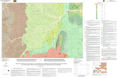
WSGS Main Website: www.wsgs.wyo.govGeologic Map of the Lance Creek 30' x 60' Quadrangle, Niobrara and Converse Counties, Wyoming, Fall River and Custer Counties, South Dakota, and Sioux County, Nebraska (2008)
$25.00
SKU:
wsgs-2008-ms-79
Availability:
NA
| Bibliographic Reference | Johnson, J.F., and Micale, D.C., 2008, Geologic map of the Lance Creek 30' x 60' quadrangle, Niobrara and Converse counties, Wyoming, Fall River and Custer counties, South Dakota, and Sioux County, Nebraska: Wyoming State Geological Survey Map Series 79, scale 1:100,000. |
| Map Dimensions | Approx. 49" x 36" |
Warranty Information
NA
