 Loading... Please wait...
- (307) 745-2250
- Home
- My Account
- View Cart

Wyoming State Geological Survey Publications Sales and Free Downloads
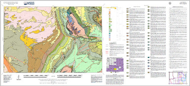
WSGS Main Website: www.wsgs.wyo.govGeologic map of the Rawlins 30' x 60' quadrangle, Carbon and Sweetwater counties, Wyoming (2025)
$25.00
SKU:
wsgs-2025-ms-110
| Bibliographic Reference |
Lynds, R.M., Schwaderer, C.W., Mauch, J.P., Lichtner, D.T., and Doorn, C.J., 2025, Geologic map of the Rawlins 30' x 60' quadrangle, Carbon and Sweetwater counties, Wyoming: Wyoming State Geological Survey Map Series 110, scale 1:100,000, https://doi.org/10.15786/wyoscholar/10065. |
| Map Dimensions | Approx. 64" x 29.5" |
