 Loading... Please wait...
- (307) 745-2250
- Home
- My Account
- View Cart

Wyoming State Geological Survey Publications Sales and Free Downloads
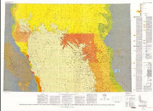
WSGS Main Website: www.wsgs.wyo.govGeologic map showing thickness of the upper Cretaceous Pierre Shale in the north half of the Powder River basin, southeastern Montana and northeastern Wyoming
$9.00
SKU:
USGS-1993-I-2380-A
Availability:
NA
Current Stock:
5
I-2380-A Geologic map showing thickness of the upper Cretaceous Pierre Shale in the north half of the Powder River basin, southeastern Montana and northeastern Wyoming, scale 1:200,000, 1993, ISBN 978-0-607-79547-9 Keywords: Powder river basin, Stratigraphic Geology, Stratigraphy, Geologic maps, Sedimentology, Sedimentary and carbonate rocks
