 Loading... Please wait...
- (307) 745-2250
- Home
- My Account
- View Cart

Wyoming State Geological Survey Publications Sales and Free Downloads
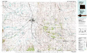
WSGS Main Website: www.wsgs.wyo.govUSGS 30' x 60' Metric Topographic Map of Laramie, WY Quadrangle
$9.00
SKU:
USGS-1982-TWY0568
Availability:
NA
Current Stock:
TEMPORARILY OUT OF STOCK - Please call for more information!
Sorry but this item is currently unavailable.
Please check back at a later stage.
TWY0835 USGS 30' x 60' metric topographic map of the Laramie, WY Quadrangle, scale 1:100,000, 1981, ISBN 978-0-607-60787-1 Keywords: Albany county, Laramie county, Topographic maps
